
Vince Erasmus
-
Posts
4 -
Joined
-
Last visited
Content Type
Profiles
Forums
Gallery
Downloads
Blogs
Events
Store
Aircraft
Resources
Tutorials
Articles
Classifieds
Movies
Books
Community Map
Quizzes
Posts posted by Vince Erasmus
-
-
The Dynon D2 mini EFIS interfaces wirelessly with mobile or tablet apps most of which have American databases and don't cater for Australian airspace. Has anyone found a useful app that works in Australia with the Dynon D2 ? It apparently allow you mirror the efis output and also, I believe tracks the flight for later download.
-
Wanting to get some airfields into my rather simple Garmin GPS and into Google Earth, I went searching. I found a file with a fair few airfield, but also some HLSs. So I took the ERSA PDFs and decided to filter the HLSs out. (ERSA show the code and name, but not the coordinates...)I then tested if there were any missing that have full ERSA entries and entered those by hand.
Because most small GPSs can't take more than 700-1000 waypoints, 1500 wasn't going to work, so I filtered then into a file per state, as well as one big file.
I also took all the VFR Waypoints from ERSA and converted these into CSV - also full and by state.
You can tell the difference between a waypoint and ALA by the way the name is formatted; ALAs are: "YPPF - Parafield" and WPTs are: "SUB + Substation".
Then I converted all into KML so you can view them in Google Earth also.
I did some random checks and some of the airfields are not very accurate, but they should get you within visual distance of where they are. You wouldn't leave without checking them on the map anyway, would you!? :)
I thought I'd share this with you folks, you may find it useful!
[ATTACH]7447.vB[/ATTACH]
[ATTACH]7448.vB[/ATTACH]
Good Day,
Is there an update to these airfields. This was in 2009.
Many Thanks
Vince
-
Hello There,
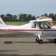
Just joined the forum. I own and fly a Jabiru J160 c out of Penfield aerodrome Sunbury.What a privilege to fly around this country !
Vince
Dynon D2 - WiFi link
in AUS/NZ General Discussion
Posted
Thank for Bevan , very much appreciated !