
DWF
-
Posts
486 -
Joined
-
Last visited
-
Days Won
3
Content Type
Profiles
Forums
Gallery
Downloads
Blogs
Events
Store
Aircraft
Resources
Tutorials
Articles
Classifieds
Movies
Books
Community Map
Quizzes
Posts posted by DWF
-
-
The item in these radio calls that cause me the most problems is the name of the location.
When you are at/near your local airfield it is generally reasonably easy to understand but when you are in unfamiliar territory the name of the location can be difficult to decipher, especially when it is mumbled, slurred or rushed.
I have recently spent over 40 hours flying through relatively unfamiliar country and on a number of occasions had some difficulty working out the name of the location (and then at times finding it on the chart).
Without wishing to add to the controversy, I think the "Traffic Location" format provides a better opportunity to hear and understand the location name.
I would ask all pilots to clearly enunciate the location name - and don't forget to repeat it at the end of the transmission.
2 other pet hates:
Reporting a height AGL rather than an altitude (AMSL); and
Reporting an incorrect or misleading position. e.g. 10 miles East when actually 10 miles West.
If you make this mistake (and recognise it) please correct it (using the phrase "Correction ....") asap.
-
 1
1
-
 6
6
-
-
Most of the above is good advice.
Think about and rehearse what your are going to say BEFORE you press the button.
I have a 'cheat sheet' of the common local calls I get students to use for the first few flights.
They generally read from them religiously for the first few flights but fairly soon become familiar and comfortable with the calls and the 'cheat sheet' is rarely consulted.
Here is an example of the example calls - just amend the numbers to suit the situation.
Radio Calls Ravensthorpe 2.pdf
Radio Calls Ravensthorpe 2.pdf
-
A drone/UAV maybe??
-
Can they do anything for some of the one-eyed posters here?

-
2
-
 3
3
-
-
I think that the RAAus constitution needs to be amended to include the requirement for a NPRM process to be followed before significant changes to RAAus rules and regs (Ops and Tech manuals, etc.) can be made.
-
2
-
6
-
-
I also use "TrackDirect - NAIPS Briefing" by Control-J - free download from Google Play Store. The icon is a 'globe' with a blue aircraft on it.can anyone recommend an android app that I could use to look up the weather?It has the handy feature of being able to show a map of those lines and areas on forecasts and sigmets showing where areas of weather, etc are.
-
1
-
-
The Area and TAF forecasts issued by MET via NAIPS are usually only valid for 6 to 12 hours (or in some cases up to 24 hours for major airports).
If you want weather for the next day you will have to use the BOM site or Weatherzone, etc and work out your own winds, etc for the route (METEYE is useful here).
It is a nuisance but in most cases you will not be able to get a valid NAIPS forecast to use to flight plan the evening before your flight.
-
The Airservices Australia NAIPS site contains the following:
...............................................
Flight Notification Form
Pilot Responsibilities
Pilots are not required, as they once were, to lodge details about tracks, headings, true air and ground speeds or time intervals. However, this does not absolve them from the responsibility of preparing a flight and fuel plan for their flight.
The methodology used by individual pilots to prepare their plans is a matter of choice, but good aviation practice and common sense dictates that a careful plan is the key to a good flight.
Information Required on the Form
The information now required by ATS to deliver air traffic control is limited to the following:
- information about the aircraft
- the radio and communications equipment on board
- the departure and destination points of the flight
- the planned route
- the cruising speed of the aircraft
- a SARTIME
- the emergency equipment on board
- the number of passengers on board
- details of the pilot
The flight notification form is divided into a number of boxes or items. Each of these items requires information delivered in a specific way.
The AIP has a complete summary of all possible options for the flight notification form in AIP ENR 1.10 Appendix 2.
Airservices has released a range of instructional videos to help pilots plan
their flights in the NAIPS Internet Service (NIS). Available at:
...................................
I recommend RAAus pilots who wish to fly in CTA/R or use flight following register for and use the NAIPS to get their weather and submit flight notifications (plans and sartimes).
I use the Champagne Flight Planner 3000 program for flight planning - it allows you to download weather and apply (automatically) winds and then check and submit your plan to NAIPS. Saves a lot of time and effort.
I do not use them (yet) but I understand OzRunways and AvPlan provide a similar facility.
Or you can submit the plan manually via NAIPS on the internet from your PC, tablet or mobile phone - check out the 'Briefing' and 'Flight Notification' tabs.
NAIPS also allows you to store your aircraft details and/or standard flight plans to make the process faster.
DWF
-
1
-
 1
1
- information about the aircraft
-
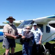
The CAGI Trophy is now at Myrup Heights (near Esperance WA) after traveling from Sharron Park via OzKosh at Narromine, the Brumby factory at Cowra and the RAAus AGM at Aldinga.
Route: Myrup Heights - Caiguna - Border Village - Ceduna - Port Augusta - Broken Hill - Bourke - Walgett - Sharron Park - Glen Innes - Dubbo - Narromine - Dubbo - Cowra - Hay - Wellington - Aldinga - Whyalla - Ceduna - Coorabie - Border Village - Caiguna - Myrup Heights. [Locations in bold were overnight(s) stops.]
Total distance: 3,574 nm (6,430 km approx)
Total Time (Start up to shut down): 43.9 hours over 24 days.
Total Fuel used: 836 litres
Average Fuel consumption: 19 litres/hour
Average Speed: 80 knots (Probably closer to 90 knots for actual flight time.)
If you wish to "Come And Get It" PM me.
-
6
-
-
And I appreciate it Hargraves.And the reason I posted it DWF. Cheers HargravesIt may also be a cautionary tale for those who seem to get a "bee in their bonnet" on these forums.
DWF
-
1
-
 1
1
-
-
That still leaves about 4500 unused numbers.The 2xxx and 6xxx ranges are assigned to HGFA for trikes registered with them. -
That's the sort of experience I would rather someone else got - and then let me learn from it (second hand)......... theirs no substitue for experience and thats what we have to get. Cheers Hargraves-
2
-
-
I have recently done over 40 hours of cross country flying lodging VFR Sartime plans all the way.
I can definitely state that for RAAus aircraft Airservices/NAIPS requires the Aircraft ID field to contain the last 4 digits of the aircraft registration. i.e. for 19-7780 the ID is "7780".
I used flight following on occasions but did not enter CTA (although I can as I also have a PPL and my aircraft has an "approved" engine [R912]) and the controller had no problem finding my plan in the "system".
My transponder is only mode C (so the mode S/ADS-B situation did not arise) but I agree that the situation needs to be clarified.
RAAus is considering re-using the same 4 numbers (in some cases) with each of the different RAAus prefixes - e.g. 19-1234, 24-1234, 55-1234 etc.
This would create a small but definitely possible chance that there could be 2 aircraft with the same ID in the system at the same time.
I think this should be avoided - there are 9999 numbers theoretically available and only about 3500 aircraft on the register so it should not be necessary to re-use the same numbers for some considerable time.
DWF
-
2
-
 1
1
-
-
Monitor the appropriate Area frequency unless you are within 10nm of an aerodrome marked on the charts.
If you are within 10nm of an aerodrome marked on the charts use the published CTAF for the aerodrome.
If there is no other published CTAF for the aerodrome use the Multicom/CTAF frequency 126.7
-
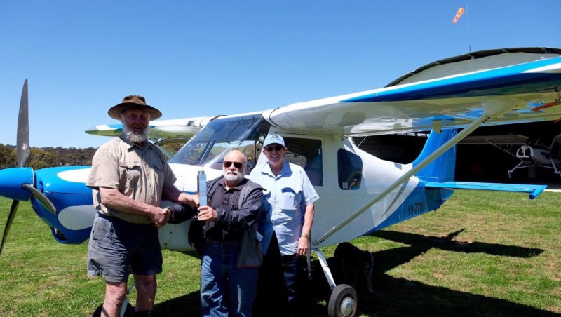
I have it and it will be on display at the RAAus stand at Ozkosh tomorrow and Sunday and then on its way to Esperance via the RAAus AGM.
Anyone who wants to CAGI will have to come to Esperance (after 23 Oct) to do so.
The Trophy weighs 2.1 kg and is about 300mm tall. It is being engraved at the moment. I will post more details after I collect it tomorrow morning.
DWF
Brumby 7780
-
Ian. How about this idea ..... it would be a lot easier to explain if I could draw a diagram ....
An 'L' shaped bracket at each end of the spa.
The bottom arm of the L at or just below floor level able to move in a horizontal channel so the vertical arm of the L can move from the centre of the spa to one edge.
At the appropriate height up the vertical arm of the L fitting connect the centre edges of the 2 cover halves so they can be rotated through 90 degrees putting the outer edges of the cover halves at the top of the L fitting. You could use manual, pully, electric motor or hydraulic means to rotate the lid halves from horizontal to vertical. When the lids are secured in the vertical position move the L fittings holding the vertical lid halves to the side of the spa.
Can you understand what I am trying to say?
Do you think it is practical and would work?
DWF
-
I plan to be there each day but staying in a motel in Dubbo due no accom in YNRM and getting a bit too old and creaky for camping (and treking to the loo in the middle of the night!)
-
1
-
-
On a more serious note ....
How much do the lids weigh?
Are they in one piece or several and/or do they fold in half or smaller?
What size are they?
Would you feel safe with them suspended from the roof above the tubs?
DWF
-
Then don't put any salt in the water or you could be charged with a salt and battery!
-
3
-
-
I disagree with this quote.......... Holding the nose high after landing decreases braking effect .............[/i]I agree that the nose wheel should be held off for as long as possible, particularly for a short or soft field landing.
However this transfers weight from the nose wheel to the main wheels thus INCREASING braking effect (and adding 'weight' by putting a down force on the tailplane).
From 'Your Guide to Short Field Landings'
"Once you touchdown, you want to use maximum aerodynamic braking, as well as maximum wheel braking. By pulling back on the yoke on the ground, you increase your aerodynamic braking, and you keep more weight on your main gear. That in turn makes your brakes more effective, because you can apply more brake pressure without your wheels locking up. Keep pressure on the brakes until you know you're slow enough to make your taxi turnoff, then gently start to let up on the brakes."
-
1
-
-
Thanks Tellerto
-
Departing tomorrow from Esperance for Redcliffe in the Brumby.
Planning to get to YGDI on Sat 1st Oct.
Does anyone know about accommodation, fuel and transport there (or nearby)?
DWF
-
Let's be arrogant - or at least assertive. What have we got to lose?Agree, but RAAus may have missed the boat! The opportunity to have input, as taken up by the GFA, Balloon Federation etc, has been missed. It will be difficult to make any significant changes now, it would arrogant to expect so.-
2
-
1
-
-
I agree.I'd suggest RAAus must be involved in the development of the Part 149 MOS.- Firstly, has the organisation has experience in the field they can provide valuable input- secondly and more importantly, to influence the development t of the MOS so it doesn't contain any unreasonable requirements.
It's too late to try and change the rules after they've been developed.
I have experienced this in the Part 61 reg's, there are organisations who should have made subject matter experts available during the development of the various Part 61 MOS, instead we are now trying to repair things with exemptions and 61.040 approvals.
RAAus needs to take a long hard look at the NPRM to ensure, as far as possible, that we agree with or can live with its contents and requirements - and fights hard to remove items that are not in our interest.
RAAus has been self-administering for quite a while and should have some idea of how the system does and/or should work.
Let's try to help CASA get it right this time - before it is too late to amend and we end up with another Part 61 debacle.
-
2
-


Man faces $9000 fine for sending drone for a sausage
in Aircraft Incidents and Accidents
Posted
I think CASA should capitalize on the opportunity/publicity this YouTube video presents to promote the message of (ir)responsible drone operation. (And maybe pay for the snag.)