
Garfly
-
Posts
3,056 -
Joined
-
Last visited
-
Days Won
67
Content Type
Profiles
Forums
Gallery
Downloads
Blogs
Events
Store
Aircraft
Resources
Tutorials
Articles
Classifieds
Movies
Books
Community Map
Quizzes
Videos Directory
Posts posted by Garfly
-
-
A new fine flying film from Frederic in France:
-
 1
1
-
-
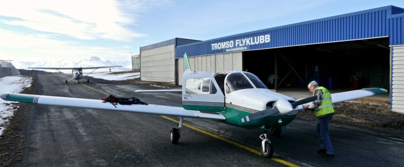
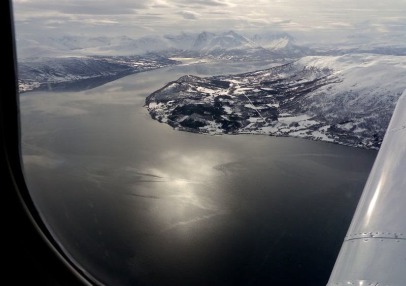
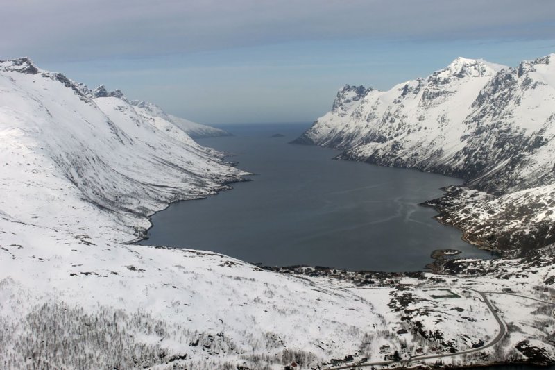
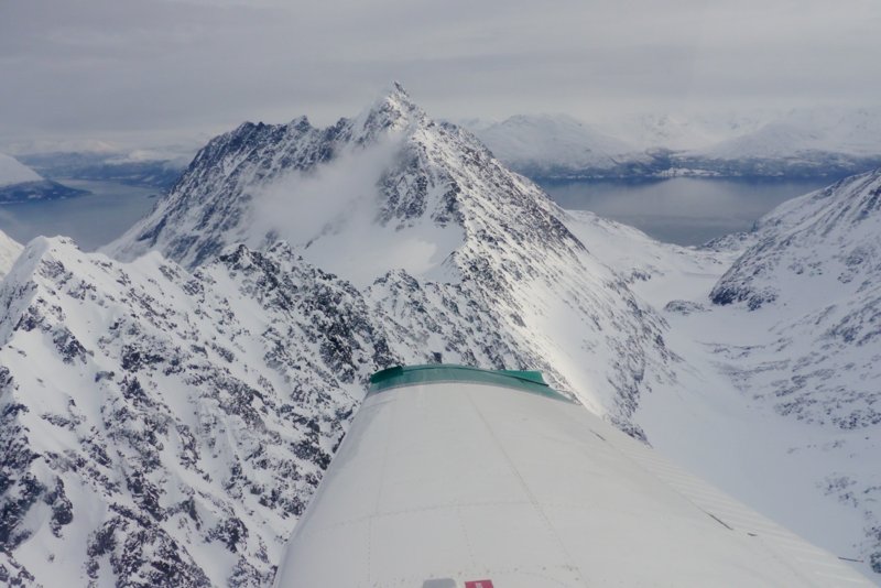
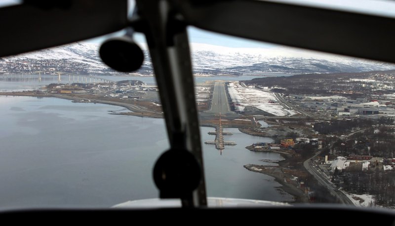
Velkommen Geir,
Trondheim is a beautiful part of the world to soar over in any season (as long as you can see ;-)
Do you have any pictures of your area and your aircraft?
I'm more familiar with Tromsø in the far north, where I usually spend a part of each year for work.
Here a few shots of a flight I had there last year in Spring from Lagnes airport with a friend in a club PA28:

-
3
-
-
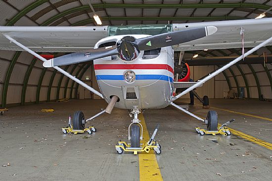
Anyone had experience of these?
If they work a set should save an awful lot of harm, hassle and hangar rash.
Seems a set of three would cost around $1700 plus import costs.
AeroJack the ultimate castor dolly system for moving light aircraft in the hangar
-
 1
1
-
-
This tragedy occurred at a non-controlled field in the US but it shows just how easy it is for vital radio comms to be missed and/or misunderstood.
-
1
-
 1
1
-
 1
1
-
-
Some amazing footage - and a great written report by the pilot - on YouTube
Video captures pilot's near-decapitation in air show
-
If you haven't found it yet, this webinar might help.
Anyway it looks like a pretty nice bit of gear.
-
and Go Around Stalls ... A recent Video from AOPA (USA)
(Sorry the thread launched itself before I could finish the title. Makes it kind of enigmatic ;-)
-
3
-
1
-
-
Yeah, I suppose they need to carry the added speed for the added flare.
Anyway, non-precision is a non-option.
But clearly a lot of planning has gone into the flying and the filming, too.
It's described in the blog's Aug. 5 entry (auto translated here:
This is someone who gets heaps of recreation out of his flying.
-
-
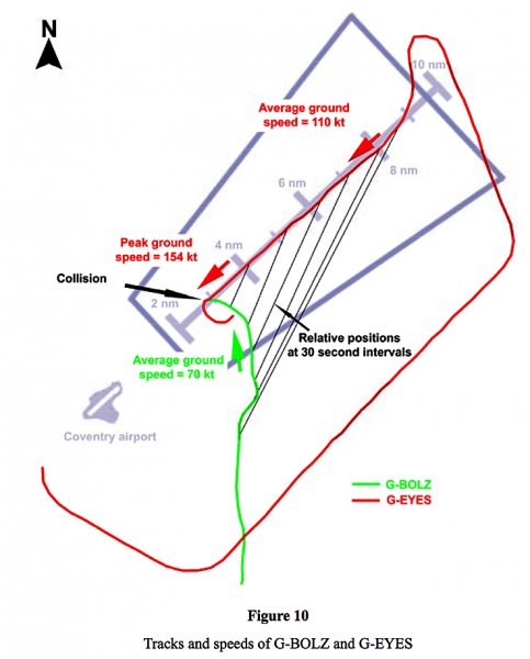
Onetrack, yes, I agree, the fatal factor at Coventry seems to have been the unusually high speed of the C402 on final (due to its ILS calibration task). This crucial (out-of-the-ordinary) fact was not grasped by the controller who'd come on shift.
Anyway, as far as I can read, the outcome had little connection with what the pilot of G-BOLZ did or didn't do and nothing whatever to do with his age.
He was, after all, following the direction of the Aerodrome Controller, sequenced #2 to follow the PA28. In fact, he was never directly informed of the C402 established on the ILS although he would have heard the controller tell some aircraft (G-EYES) to follow him as #3. So he was entitled to assume that his right flank was more or less protected and that it was his job to make sure the landing PA28 (#1) was in sight and well clear. Of course, he should've - probably would've - instinctively 'cleared-right' visually, at least prior to turning final but, then, it never came to that. Before the turn he was directed to fly on through finals since the controller realised that his sequence plan wasn't working out. Too late, too late.
If an "Inattentional Blindness" issue arose, here, it might have been more with the 402 crew although the report says that the small G-BOLZ was probably hidden from the view of the Cessna's lookout pilot by the central windscreen pillar. It's also mentioned that since they were on an IFR plan, that crew's expectation might have been assured protection from VFR circuit traffic. This, though, was not technically/legally true since the whole thing was actually happening in G airspace. (As far as I know, this contradiction: tower 'control' in 'uncontrolled' airspace does not arise in Australia, at all. But then, if the UK had our system, there'd probably be precious little G airspace available there at all.)
Anyway, much to learn from this tragedy, for which, it seems, no individual was clearly to blame.
For me, one lesson is to keep one's head moving around fixed obstructions checking for the worst of threats - the hidden and/or unmoving ones. Another lesson: when doing anything in the air other-than-might-be-expected, especially near airports, let others know so they can be on guard against normal (false) assumptions.
But there's nothing in this report that warns me against getting old(er), especially.
Still it's true (G.B.Shaw said it first, I think) that whereas recreational flying is the most wonderful thing in the world, it's a shame that it's wasted on the old.
BTW: I note that the first commenters on Kathryn's Report (Post #37 above) jumping in about the West Georgia accident were quick to blame the oldness of the old guy. Never mind the rules of evidence ... nor defamation.
-
1
-
1
-
-
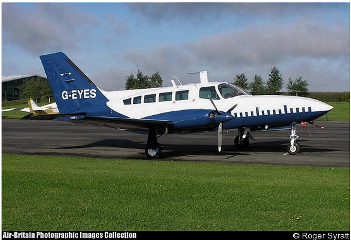
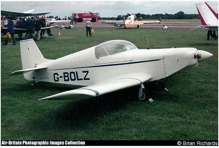
The collision near Coventry airport in 2008, killing five, also shows that even having a tower is no guarantee:
https://assets.publishing.service.gov.uk/media/5422f6dd40f0b613420005b1/8-2010_G-BOLZ_G-EYES.pdf
-
I recommend Ralph Burnett at Rainbow Coast Flying School, Albany.
http://albanyflyingschools.com.au/contact-us
0427200673
-
1
-
-
Parts 2 and 3 now available on iView:
David Attenborough's Conquest Of The Skies - Series 1 Ep 3 Triumph (Final) : ABC iview
-
1
-
-
Some suggestions from a fellow aeroplane-tragic: if you take your VHF portable along you can at least listen to Sunshine Coast tower to distract you from banana chair distress syndrome.
And if you stroll down to Marcoola for coffee you can even watch traffic arriving on Rwy 18 as you sip your Macchi-ato.
Plus, you'll only be a stone's-throw from Gympie airport where there are lots of fellow sufferers to talk to.
-
Is this the one?
-
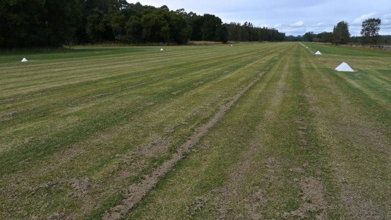
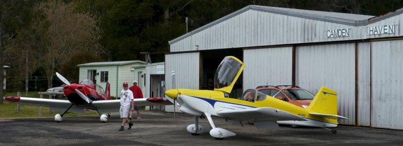
If it's the Johns River south of Port Macquarie that you're meaning you could try Camden Haven. The other one on the southern shore of the lake is called The Lakes but I believe that is pretty much for the private use of the owner. Both are in ERSA.
Camden Haven Airfield, light aircraft grass strip, NSW mid north coast
-
 1
1
-
-
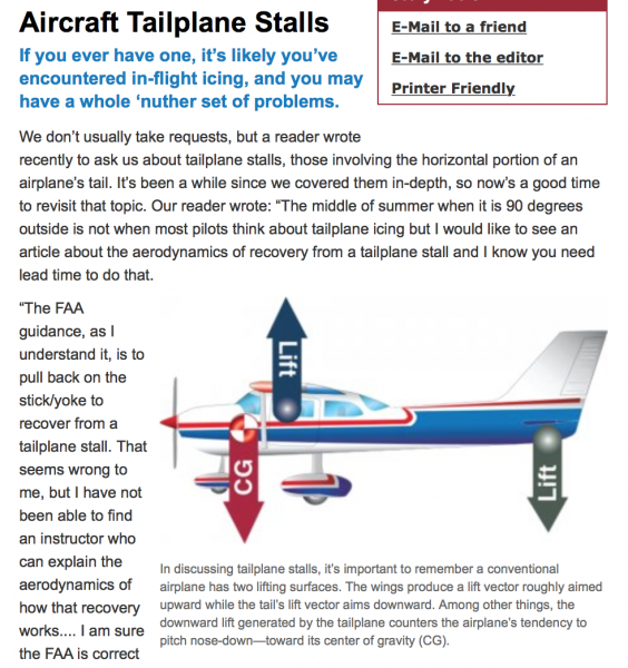
This recent article on tailplane stalls is not all that relevant here ... but somewhat:
Aircraft Tailplane Stalls - Aviation Safety Article
-
1
-
1
-
-
-
A great report Peter. Really well written and presented. Thanks for posting. Looking forward to Part II.
Did you have special fuel cards to pay for your fuel or did you use a normal credit card?
-
Yes, it's a useful exercise to think these things through and I do take the points raised.
I understand that at the point of stall, lift/drag forces are still very much in play (on main and tail) but I'm left wondering, at what point does the simple law of the lever take over the show - for most intents and purposes.
Any way good luck with your BAK. (Shouldn't you be sitting the ATPL? ;-)
-
2
-
-
Yes, thanks Roundsounds. I edited my post to 'most lift goes' before I saw your reply.
(And I certainly wouldn't want to blame my many long-suffering instructors over the years for my poor grasp of aerodynamics. ;-)
-
Obviously a good question RJW.
I must admit that my own answer would have been close to the 'obvious' one you first mentioned, i.e, that "there is a loss of lift and the heavy nose of the aircraft makes the whole plane pitch down." And, truth be told, I can't say I'm persuaded otherwise yet.
If I imagine a (normally loaded) aircraft suspended at its CG on a very high crane boom and then being dropped from a great height, I imagine it's always going to pitch immediately nose down and - given a bit of height - try to fly. That is, to 'plane'.
And if I bring to mind aerobatic displays I've seen, including the occasional tail slide, it always seems to me that the stalled aircraft - like a ridden horse - is always hankering to head for home - nose first.
I'd just assume that 'when all (or most) lift goes, down goes the nose' is a basic mantra for all 3-axis aeroplane designers.
Is my understanding too simple?
-
1
-
-
Okay, since we've moved on from the term to the thing-itself, this post from M61A1 caught my eye a few weeks back. Especially the part "Mind you if I looked like running out of altitude, I could have levelled the wings and landed with no obstacles any time through the turn."Have to agree about landing into wind is possible.I had an engine out on climb out( after a dummy approach with a tailwind) around 300', I was off the runway centreline deliberately, as it takes me over a nice open paddock. Knowing I had a good tailwind component, I maintained my airspeed and immediately started a right turn, and was just rolling my wings level just prior to touchdown. The turn of about 170 degrees both got me a nice slow touchdown and lined up with the furrows. I could have landed straight ahead touching down in soft soil at around 60kts ground speed, instead I had around 30. Mind you if I looked like running out of altitude, I could have levelled the wings and landed with no obstacles any time through the turn.I thought it made a lot of sense - a 3rd way between the Impossible Turn and the Possibly Possible Turn positions. It might be called the continuously assessed and safe upwind turn or CAASUT.
-
For those interested in this debate here's yet another Dick Collins article which has a very exhaustive discussion thread after it.
What's wrong with Cirrus pilots? - Air Facts Journal
The general consensus seems to be that the main reason for the poor Cirrus accident record has less to do with the design and more to do with human factors; that the typical 'mission' for the plane is as a serious transport tool - not so much just for fun-flying - so that it's often being flown single-pilot IFR in marginal weather and by pilots with marginal skill levels.
To save having to trawl through the whole thread, here's a typical SR22 fan commenting on the venerable 'parachute-in-place-of-spin-resistance' charge:
"The spin comments are really very silly. Just a little bit of research will show that the Cirrus can recover from spins just fine…in fact, it had to in order to be certified in Europe. Cirrus simply chose not to spend the extra money to show all the certification data to the FAA due to the fact that they spent engineering money on the chute and that met the standard. When it costs like a bizzillion dollars to certify a new design, a million here and a million there add up to real money. The cirrus is not some crazy handling plane that is just dying to spin you into the ground…and impossible to recover. I’d venture to say it’s just as good or bad as any other high performance single."
-
1
-
1
-

That damn windsock!
in Student Pilot & Further Learning
Posted
It's a good topic RJW; so straightforward it rarely gets raised.
(But when it does you're glad to find you're not the only one wondering.)
Here's a recent, relevant "I Learned about Flying From That":
I Learned About Flying From That: Hazardous Habits