SDQDI Posted April 22, 2014 Posted April 22, 2014 I had the opportunity to do my first solo crossing of the great divide this morning and thought I would share the experience. I have crossed it before but not on my own and never on the track that I flew today. I had to take the hornet back to taree to 'correct' some slight wind damage that I had temporarily farm boy repaired:strong: and seeing the weather the last few days has been pretty good i decided I would take the plunge and go this morning, I gave her a wash last night and fuelled her up and generally got her ready so all I had to do was the daily this morning. A quick look at the forecast showed I would have a 20 to 25 knot tailwind at my planned altitude (flying from YQDI I had to go under controlled airspace but wanted to be as high as I could I ended up doing most of the trip at 6500). From talking to others it seemed that a fairly direct route was possible so that is what I planned to do. I took off at about half past eight after getting kids and mum ready so they could come and pick me up and did a nice steady cruise climb. A beautiful still morning on the ground. It wasn't long till I started to see the benifit of the tailwind but it wasn't the 20 to 25 knots that I was expecting it was much better than that, I was poking along at 65 to 70 knots indicated and the GPS was reading 110 to 120 (roughly a 50 knot tailwind).As soon as I saw that it got me thinking I knew that lower down would be dangerous and turning back would have had me hovering. It was still very smooth where I was with no rough air at all but I did want to get higher. We have all read about mountain waves and I admit it was going through my mind but I was a good 2000 feet above the highest peaks (I was keeping over the valley most of the way so I wasn't too far away from a half decent forced landing paddock). I didn't experience any turbulence at all and no great sections of lift but I did get a huge sink for a minute or two (throttle wasn't to takeoff power it was at 5400 which at 60 knots on my own gives me somewhere around 500 FT/min climb but I was sinking at 600 still:thumb down: so that was quiet an experience and I was extremely glad I wasn't any lower, but as I got closer to the next ridge it stopped and I climbed so I was back to my 6500 and didn't have any more hassles. So I learnt a bit today while I never felt uncomfortable it was definitely an experience:yes:. If anyone else does a lot of over the range flying I would love to know how you find the wind? Is it regularly higher than forecast? or is it the same as most other places ie they don't always get it right? Anyway don't shoot me down in flames but I would love to hear some more 'tales' or experiences. 6 1
Gnarly Gnu Posted April 22, 2014 Posted April 22, 2014 Nice read SDQDI, thank you. I gave her a wash last night and fuelled her up and generally got her ready so all I had to do was the daily this morning. ....gave the cowl a gentle massage..... tweaked her jets. Then tossed the wife & kids in a car to come pick me up.... (sorry couldn't resist). 1
metalman Posted April 22, 2014 Posted April 22, 2014 Crossed it a few times,,,the last time was the hardest, had a 40 + headwind was only getting 38-40 across the ground ,it was a very slow trip from maitland to Bathurst , I wouldn't go that way again Matty 1
Dafydd Llewellyn Posted April 22, 2014 Posted April 22, 2014 You're essentially crossing over Barrington Tops, from Quirindi to Taree, aren't you? I've travelled VFR north-south over that area many times; to avoid the Tamworth zone I tracked Armidale - Mt Sandon - Scone- Cessnock (or the reverse). That keeps you over landable country. You should be able to go Quirindi- Wallabadah - Mt. Sandon - Walcha (or pretty close to that) and thence to the coast without too much mountain wave effect. Bit of a dog-leg but not as dire as direct over-the-top. There's some tiger country East of Walcha; you need sufficient height to cross that, which would be the critical weather consideration. Mt. Sandon is a VOR site, you'll need to find it on an RNC, I expect; hard to spot visually, but it's right on the edge of the scarp, close to a small reservoir. You wouldn't need to pin-point it, but cut the corner to the south over the Walcha plains.
SDQDI Posted April 22, 2014 Author Posted April 22, 2014 You're essentially crossing over Barrington Tops, from Quirindi to Taree, aren't you? I've travelled VFR north-south over that area many times; to avoid the Tamworth zone I tracked Armidale - Mt Sandon - Scone- Cessnock (or the reverse). That keeps you over landable country. You should be able to go Quirindi- Wallabadah - Mt. Sandon - Walcha (or pretty close to that) and thence to the coast without too much mountain wave effect. Bit of a dog-leg but not as dire as direct over-the-top. There's some tiger country East of Walcha; you need sufficient height to cross that, which would be the critical weather consideration.Mt. Sandon is a VOR site, you'll need to find it on an RNC, I expect; hard to spot visually, but it's right on the edge of the scarp, close to a small reservoir. You wouldn't need to pin-point it, but cut the corner to the south over the Walcha plains. Not quiet so far down as the barringtons seems the best track is from qdi skirting around/under the controlled airspace to nowendoc then following the valley down (which is essentially what you were saying with the qdi to mt sandon except I wouldn't go up to walcha), but I was a valley or two to the south it would have been about halfway between mt sandon and the barringtons. Also have the option of going down to mainland and up the lane which isn't to bad but you are forced to stay low going that way and it nearly doubles the travel time. Weather does normally play a big part in it as often it will be fine on one side but miserable on the other which limits the hill skipping. It's no wonder they call it the great divide
alf jessup Posted April 22, 2014 Posted April 22, 2014 SDQDI, I have crossed the divide probably a dozen or more times both in a 912 powered trike and 3 times in my Tecnam mostly from West Sale in Victoria to Porepunkah and a few times to Yarrawonga. One time planning to head to Yarrawonga in the trike following the Licola Valley to Mansfield the forecast aloft winds looked ok but on reaching 6500 with an intent to traverse at 8500 I was punching in to a 43kt headwind (silky smooth) with a mammoth GS of 17kts, discretion being the best part of valour after finally reaching Licola after 55mins and the GPS telling me that 40 odd NM away was Mansfield 2:15hrs away I spun around and made it back to YWSL in 17 mins (104kts GS max at alt) and smooth all the way down. (I drove up that day) Another time coming back from Yarrawonga again in the trike with forecast winds of 40kts aloft (was at my assigned alt well before Mansfield staying outside of the 8500 control step out of Melbourne) had a GS 0f 105kts at altitude and silky smooth air with a 300fmp decent then accent as I passed over some of the valleys & ridges way below me in the range. Had a couple of 130kt GS crossings in the Tecnam heading back from Porepunkah via either the Dargo Valley of following the valleys past Omeo around to Bairnsdale. I am always at my assigned altitude well before the start of the divide heading either direction and a minimum of 2500ft above the highest mountain but usually higher depending on the hemispherical direction I am travelling. I have never run in to any serious mountain wave as yet (and frankly don't want to or an immediate 180 will be on the cards no if's or butts) and always pick my days and check the forecast thoroughly. My only real concern when flying up over there is recovering my machine if I had to put it down due to EF and I survived unscathed, I always let someone know my flight track and that I will be tracking to keep within the gliding range of the various cleared valleys en route. A lot more options up in the divide where I cross than some may think and height is your friend but never higher than 9500 in any crossing thus far. My Tecnam is fitted with a transponder and it is always on every time I fly, I am also tuned in to Mel centres frequency for that particular area I am in whether flying local or on a trip over the top. Alf 3
alf jessup Posted April 22, 2014 Posted April 22, 2014 Footnote on what I wrote above. If some on here think I am mad doing these crossings my point is this, I think I am far safer up there doing these than mixing down low amongst the power lines that some of our past brothers have played with and ultimately met their demise. There is a risk in any flight we take and if you plan it well and stick to it you have an above average chance of succeeding. Alf 1 1
metalman Posted April 22, 2014 Posted April 22, 2014 I guess I cross the range a lot more than I think, flying out of Coldstream I'm regularly tracking through the gaps in the mountains , there's a few rules I follow to stay safe , the main one is if it's low cloud and windy I don't ever bother , other wise I never cross a ridge at 90deg , never fly in the lee of a ridge, always leave a back door option, and always take the long way if it's safer ground,,,,,till I moved to Melbourne I hadn't flown around the mountains and valleys much , local knowledge is paramount I've found, Matty 1 1
sfGnome Posted April 22, 2014 Posted April 22, 2014 I had an 'interesting' moment fairly early after getting my X-country endo. Heading north into a strong headwind, crossing an east-west mountain range, I only left a bit over 500' ground clearance. Approaching the range, she started descending at a fair rate of knots. I was on the edge of chucking a U-ey when it flattened out and I could climb again, but I've always approached mountains with a lot more respect (and a lot more clearance) since then. 2 1
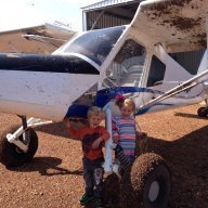
SDQDI Posted April 22, 2014 Author Posted April 22, 2014 Well done!For interest, can we see your track? I started my followmee app before I left but it didn't seem to record the trip?? Will have to play around with it a bit more. But basically I took off from 3miles north of YQDI tracked slightly north of wallabadah under the 6500 control ceiling and then pretty well followed the Bernard river down. Ill try and upload a screenshot of ozrunways which I took because I doubt the poor little hornet will get that quick again for a while:wink:
SDQDI Posted April 22, 2014 Author Posted April 22, 2014 Footnote on what I wrote above.If some on here think I am mad doing these crossings my point is this, I think I am far safer up there doing these than mixing down low amongst the power lines that some of our past brothers have played with and ultimately met their demise. There is a risk in any flight we take and if you plan it well and stick to it you have an above average chance of succeeding. Alf On the drive back near Gloucester there is a big line that goes from one peak to another every time I see it it scares me (and that is in a car) it might not be 500 feet up there but it doesn't look like it would be far off. Pretty sure it's in the restricted area but still the thought is always with me that it's probably not the only one set up like that. 1
alf jessup Posted April 22, 2014 Posted April 22, 2014 On the drive back near Gloucester there is a big line that goes from one peak to another every time I see it it scares me (and that is in a car) it might not be 500 feet up there but it doesn't look like it would be far off. Pretty sure it's in the restricted area but still the thought is always with me that it's probably not the only one set up like that. Yep stay away from that, I haven't noticed one yet above 6500ft or 500ft matter a fact but I bet somewhere in the world there will be plenty strung across valleys. Alf
kaz3g Posted April 22, 2014 Posted April 22, 2014 SDQDI,I have crossed the divide probably a dozen or more times both in a 912 powered trike and 3 times in my Tecnam mostly from West Sale in Victoria to Porepunkah and a few times to Yarrawonga. Alf Hi Alf When you come up the Valley towards Licola, are you following the Macallister? And do you then skip over Mt Skene into the Jamieson? I guess Sale needs to be inactive? :-) And when you go south through Porepunkah, do you follow the Alpine and Dargo HP Roads or the rivers? John Buckley (Ben's brother) says there is a way through where you don't need to climb more than a few thousand feet, but I can't see it on the chart. Don't forget lunch on Saturdays at 12:30 at Shepp. John is a regular. Kaz 1
alf jessup Posted April 22, 2014 Posted April 22, 2014 Hi AlfWhen you come up the Valley towards Licola, are you following the Macallister? And do you then skip over Mt Skene into the Jamieson? I guess Sale needs to be inactive? :-) And when you go south through Porepunkah, do you follow the Alpine and Dargo HP Roads or the rivers? John Buckley (Ben's brother) says there is a way through where you don't need to climb more than a few thousand feet, but I can't see it on the chart. Don't forget lunch on Saturdays at 12:30 at Shepp. John is a regular. Kaz Kaz, Via Licola I am just to the east of Mt Skene within gliding range to it as that is one of my options if I cant make it back toward the Licola valley, then usually track from there towards Elidon or the closest valley, have tracked NE when passing Mt Skene as there are a couple of small clearings hidden in the valleys. Have done direct from PPKA to YWSL over the Wonnangatta valley but only a couple of times as the options are further apart. Usually when I pass Hotham I turn right and join up and follow the high plane road towards Dargo. When tracking via Bairnsdale I fly over the hills with Livingstone valley off to my left within gliding distance. I think the LL route Ben uses is from Benambra up via Dartmouth to Albury, not sure if you would ever get this side (Dargo ect) other than down the Omeo valley though Swifts creek and Bruthen at 2500, but then again he has bigger cahoonas than me and it could be possible, actually I know it is possible as I have read it in his Buckley's chance book I have and in that his mate was looking at the leaves on the tree tops. But for this little black duck if the weathers down to make me want be following above the tree tops down valleys I'll spend whatever it takes on hotels and wait. Alf
alf jessup Posted April 22, 2014 Posted April 22, 2014 Kaz, And yep Shep is on the cards in the not to distant future for a meet, greet & lunch
Dafydd Llewellyn Posted April 22, 2014 Posted April 22, 2014 Yep stay away from that, I haven't noticed one yet above 6500ft or 500ft matter a fact but I bet somewhere in the world there will be plenty strung across valleys.Alf The simple fact is: the catenary shape of a powerline NEVER hangs upwards from its supports. If you stay above the ridge tops, you won't hit one. 1
metalman Posted April 22, 2014 Posted April 22, 2014 The simple fact is: the catenary shape of a powerline NEVER hangs upwards from its supports. If you stay above the ridge tops, you won't hit one. A mate showed me some lines strung across a valley near his place at Maindample,,,,sitting in a ute ,parked, I could barely see them , in a plane ,no hope, I try to be the highest thing in the valleys but it's not always possible if your landing somewhere,,,,again I always ask the locals about this kinda stuff. There's a nasty high and long pwr line across eildon , I've been told about it ,and it has claimed lives ,but never seen it. A mate who flies AG reckons if you can to go under them, less chance of getting hung up, of course you have to see them first,,,,any thoughts? Matty
Dafydd Llewellyn Posted April 22, 2014 Posted April 22, 2014 Also across Warragamba dam and Cataract dam - and a thousand other places. You will only see them (unless they have visibility balls) if they are silhouetted against the sky - this is the Ag pilot's trick - but look at the statistics for wire strike in Ag aircraft - and even then you will have only split seconds to take evasive action. Also, most Ag aircraft are designed to provide maximum survivability in the event of a wire-strike crash; no GA or recreational aircraft is set up that way; it won't balance. If you make a habit of flying down valleys, sooner or later you will hit one. Wires are always a concern if you're landing on other than a licenced aerodrome; there's a lot to be said for overhead circuit joining and making a habit of steep approaches; the dive brakes on gliders are very useful in this regard. Learn to side-slip. A dragged-in approach is asking for trouble.
metalman Posted April 22, 2014 Posted April 22, 2014 Also across Warragamba dam and Cataract dam - and a thousand other places. You will only see them (unless they have visibility balls) if they are silhouetted against the sky - this is the Ag pilot's trick - but look at the statistics for wire strike in Ag aircraft - and even then you will have only split seconds to take evasive action. Also, most Ag aircraft are designed to provide maximum survivability in the event of a wire-strike crash; no GA or recreational aircraft is set up that way; it won't balance. If you make a habit of flying down valleys, sooner or later you will hit one. Wires are always a concern if you're landing on other than a licenced aerodrome; there's a lot to be said for overhead circuit joining and making a habit of steep approaches; the dive brakes on gliders are very useful in this regard. Learn to side-slip. A dragged-in approach is asking for trouble. Yep to the steep approaches , and the side slip, my jigger has very few options to get down in a hurry so a side slip is top of the list in the bags of tricks, sadly it doesn't seem to be taught a lot in the schools today, I was taught to glide in with RAA but the GA schools seem to prefer long flat finals Matty
Recommended Posts
Create an account or sign in to comment
You need to be a member in order to leave a comment
Create an account
Sign up for a new account in our community. It's easy!
Register a new accountSign in
Already have an account? Sign in here.
Sign In Now