James_4870
-
Posts
24 -
Joined
-
Last visited
Content Type
Profiles
Forums
Gallery
Downloads
Blogs
Events
Store
Aircraft
Resources
Tutorials
Articles
Classifieds
Movies
Books
Community Map
Quizzes
Videos Directory
Everything posted by James_4870
-

Report from Kobe Bryant chopper crash investigation.
James_4870 replied to red750's topic in Aircraft Incidents and Accidents
Apart from the mis-pronunciation of ADS-B (adsbee) this is quite an instructive reconstruction. If the time stamping is fairly accurate I am unsure how a pilot who was aware he’d just gone from 2000 fpm climb to a +2000 fpm decent can still be communicating calmly with ATC. -
It's not something I've tried but it doesn't look hopefull (I know it's not exactly your question) https://ozrunways.tenderapp.com/kb/frequently-asked-questions/can-iphone-tethering-hotspot-give-the-ipad-a-gps-position-no-and-here-is-why
-
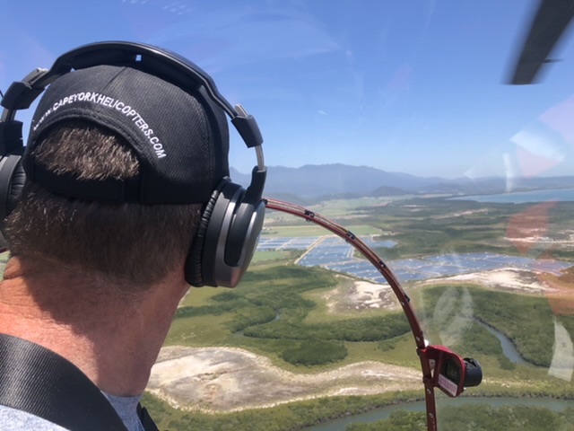
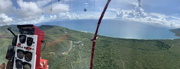
Scenic around Cairns on Sunday (24/5/20). Very quite with not another aircraft to be heard. Here’s a shot of Cairns Airport from (almost) over the 15 threshold at 1000ft.

-
Obviously there were a fair few holes in the cheese. (o.14% being a very big one). It is also noteworthy for us recreational flyers that this was a private operation and therefore more than likely not subject to the same level of scrutiny as an AOC operation. As private / recreational flyers we are probably less likely to come to the attention of CASA until something goes wrong, and certainly we have no chief pilot to be accountable to ona day to day basis. With that in mind we should make sure we look at our flying with a critical eye, stay current, be honest with ourselves and de-brief any mistakes we make and not become complacent otherwise we will likely face greater risks and the inevitable scrutiny, and nobody wants that.
-
Using Ozrunways & Garmin 660
James_4870 replied to James_4870's topic in Instruments, Radios and Electronics
update. I’ve just discovered another complication. If the waypoint exists as part of the standard database on ozrunways but not on the Garmin (eg a helipad) it is dealt with differently with each of the formats. FPL format will completely omit the waypoint completely when it’s imported, GPX format will import the waypoint as a ‘point’. -
I use Ozrunways on an iPad primarily for planning and use the Garmin Aera 660 for inflight navigation assistance (heavens forbid we should use it for actual navigation). After a lot of frustration and an inability to find any documentation on the subject I’ve done a heap of testing using an SD Card and thought I’d report my findings here, it might help someone else. The first part is the same: Format SD card - I used SD from eater free app for the mac. I am using a tiny ancient 8Gb card as the garmin files are very small so don’t go spending a fortune on a card. Create flight plan in Ozrunways. From within the flight plan screen select the share button and you are presented with 2 Garmin options (.FPL or .GPX), differences explained below. Save the file to the root directory of the SD Card. Remove card from iPad card reader and pop it into the Garmin. What happens next depends on whether you selected GPX or FPL format and the results are different once you put the SD Card into the Garmin. Here are the differences I have discovered between the 2 formats GPX Format Once you insert the card in the Garmin it will automatically import any .GPX files it finds that it has not already imported and put that flight plan in the list. The flight plan will remain in the list even if the card is removed. If you delete the flight plan and re-insert the card IT WILL NOT re-import the flight plan. You have to re-save the flight plan from Ozrunways or you can open the files app on the iPad and duplicate the file of the flight plan and then it will re-import it. Any waypoint included in the plan but not on the Garmin will show on the Garmin as a ‘point’. I don’t know what that means but it is NOT a user waypoint and will only last as long as the flight plan is in the Garmin. If the flight plan is deleted the ‘point’ will be deleted with it. The waypoints In the plans have nice upper and lower case plain english names FPL Format Flight plans are not automatically imported. When you insert the SD card in the Garmin go to flight plan list -> menu there is an option to import. This will bring up a basic file browser to allow you to select the required flight plan. The import is non-destructive, that is you can import the flight plan multiple times (it will just create a duplicates on the Garmin) Imported plans remain on the Garmin when the card is removed. If plans are deleted from the Garmin they can be re-imported from the card Any waypoints not in the Garmin will be added to the database as a User Waypoint and will remain if the Plan is deleted. The waypoint names are truncated to 5 characters all uppercase I hope that helps someone. As a side note, if you want to get some waypoints out of Ozrunways and into the Garmin you can simply create a flight plan with the waypoints in, USE FPL format above and then once imported delete the plan and voila.
-
-
-
-
 New. Years day 2020 flight over the Daintree
 -

-
Not much helicopter action on here
James_4870 replied to James_4870's topic in Just Landed - Welcome
Or alternatively a rose amongst the thorns
-
Not much helicopter action on here
James_4870 replied to James_4870's topic in Just Landed - Welcome
Oh dear, the Darwin awards come to mind! -
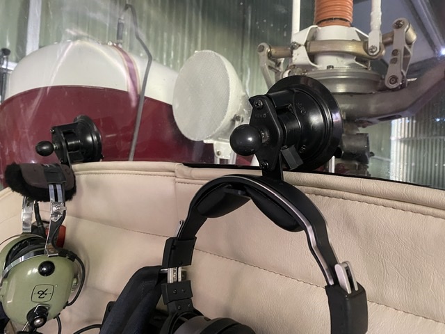
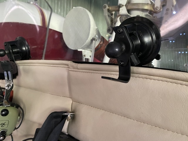
I’ve had a constant issue with headset hanger in the 47 as there is not much in the way of attachment points. After ponder for a while I’ve come up with this solution (mk1 at this stage). I’ve adapted a ram mount with a small piece of aluminium bar. I decided to leave the ram ball on there to keep its function as a GoPro mount. Might help someone with limited options.
-
Not much helicopter action on here
James_4870 replied to James_4870's topic in Just Landed - Welcome
nice. Those caps must be a collectors item by now! ??
-
I found this on another site. I don’t know if it’s a real quote or not but either way I can relate ?? "Helicopters are different from airplanes. An airplane by its nature wants to fly and, if not interfered with too strongly by unusual events or by a deliberately incompetent pilot, it will fly. A helicopter does not want to fly. It is maintained in the air by a variety of forces and controls working in opposition to each other, and if there is any disturbance in the delicate balance, the helicopter stops flying, immediately and disastrously. There is no such thing as a gliding helicopter.’ ‘This is why a helicopter pilot is so different a being from an airplane pilot, and why in general, airplane pilots are open, clear-eyed, buoyant extroverts, and helicopter pilots are brooders (worrying about everything), introspective anticipators of trouble. They know if anything bad has not happened, it is about to.’.... US journalist Harry Reasoner, 1973
-
Not much helicopter action on here
James_4870 replied to James_4870's topic in Just Landed - Welcome
such a shame. it’s hard seeing photos or derelict aircraft, seems such a waste. -
Not much helicopter action on here
James_4870 replied to James_4870's topic in Just Landed - Welcome
Hi Eric, What a great shot! Barry is PIC for the first entry in my logbook, 10 Dec 1990. Learnt to fly with him in YMBA over the following 8 months finishing my CPL in August 91. Great bloke and I loved every minute of his instructing. -
Not much helicopter action on here
James_4870 replied to James_4870's topic in Just Landed - Welcome
Hey, I did notice your name was on them, a mammoth effort, well done sir! I believe someone has just put together a J in Bankstown (vh-utz), not sure of it’s history but maybe one of the TAA or Ansett ones. Yes feel free to use any of the photos and let me know if you need a bigger file size and I can whizz it through by some other means. I look forward to reading it. Cheers -
Not much helicopter action on here
James_4870 replied to James_4870's topic in Just Landed - Welcome
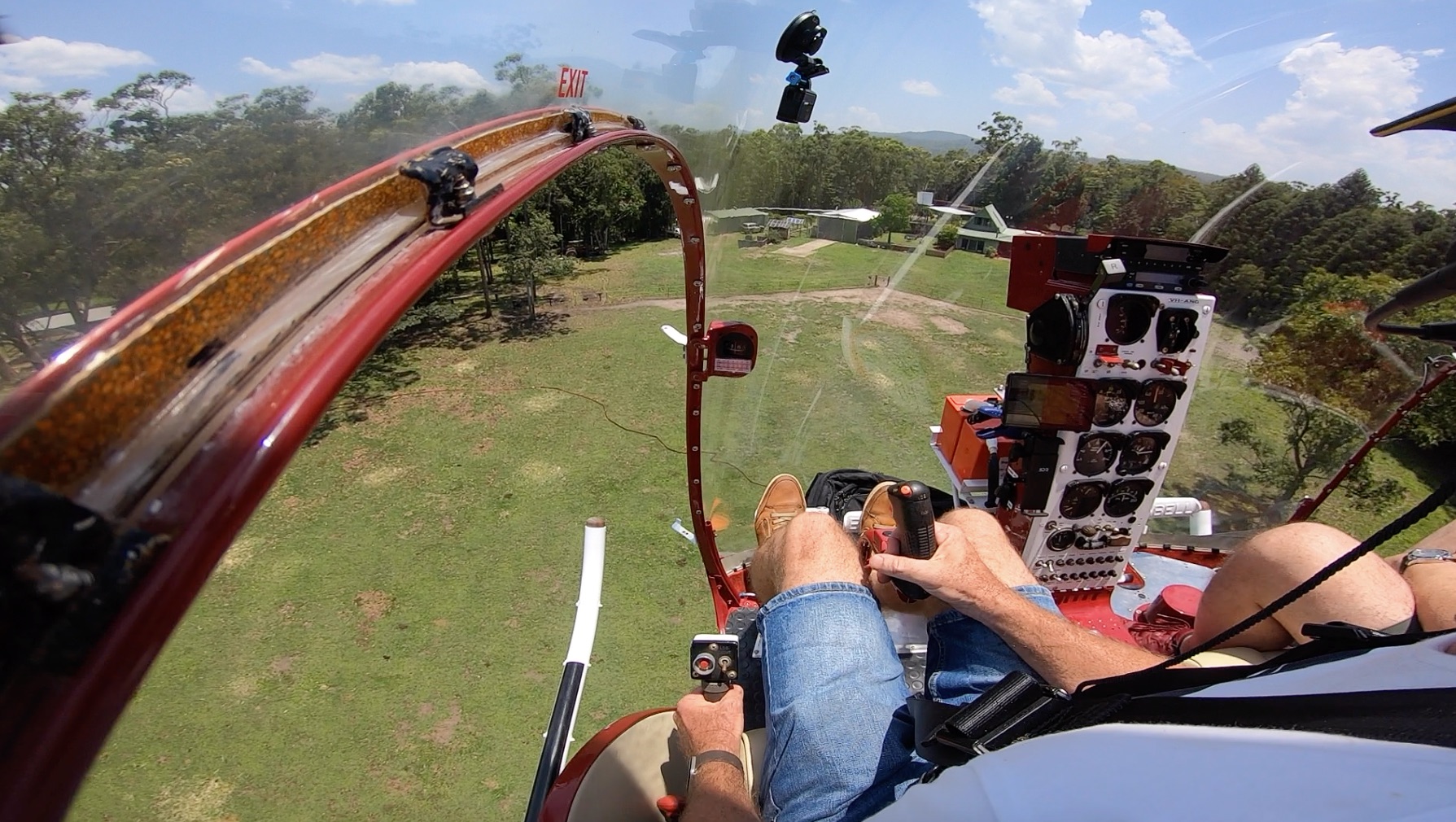
Ok, I promise not too many, perhaps just a quick video of a departure ?? -
Not much helicopter action on here
James_4870 replied to James_4870's topic in Just Landed - Welcome
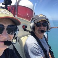
sure is, am lucky enough to have a very short walk from home to hangar.
-
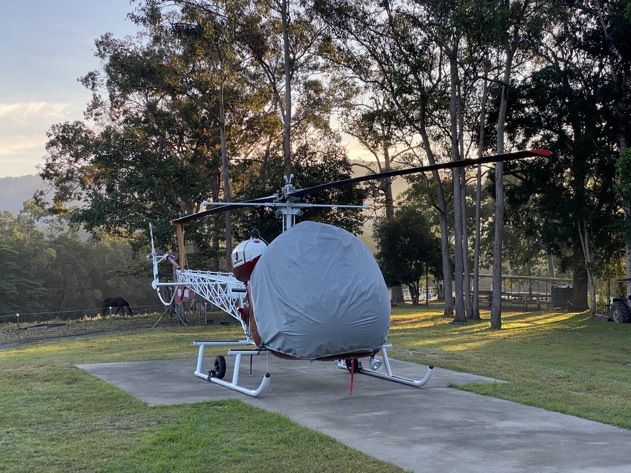
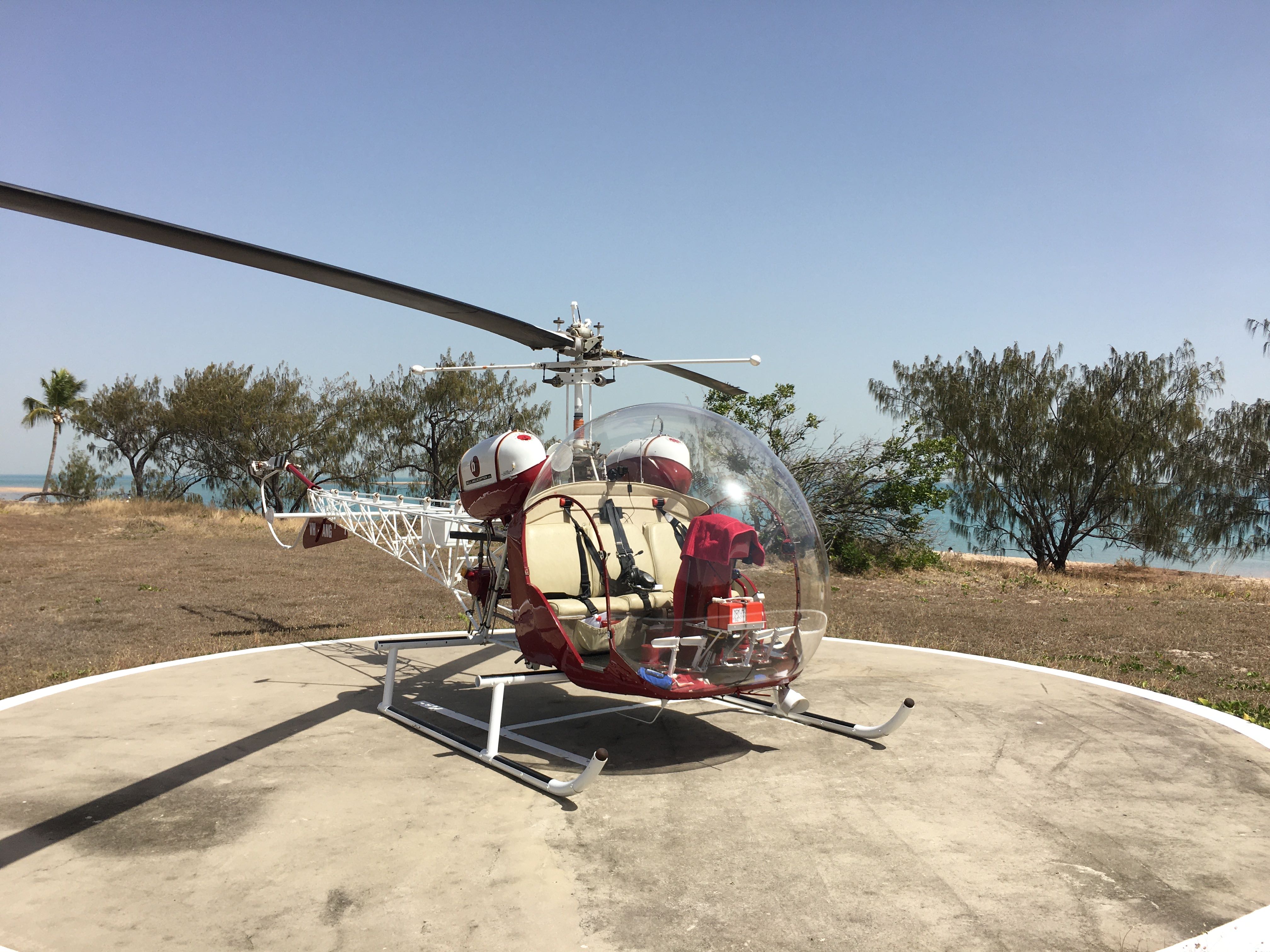
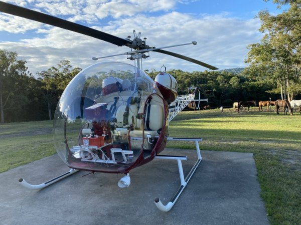
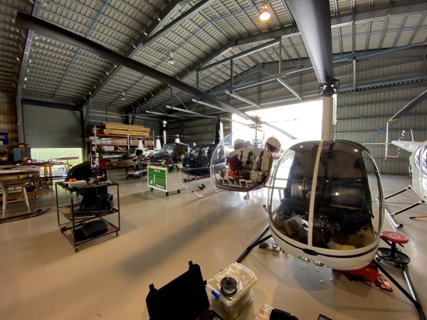
Maybe we can change that. This is my Bell 47 located in FNQ. Such an iconic aircraft but no entry in the showcase section, maybe we can change that too.