
saccani
-
Posts
55 -
Joined
-
Last visited
saccani's Achievements
Well-known member (3/3)
-
For those who have forgotten their Latin, Agricola means "peasant". In the fifties, a lot more people would remember their Latin, so it might not be such an endearing name for an aircraft.
-
I hate to be a wet blanket, but no Kittyhawks were assembled in Australian between September 1942 and January 1943. There were two Kittyhawks damaged on ferry flights in November 1942, but they had both been assembled and issued in March 1942 to 76 Sdn. The Kittyhawk crashes on ferry flights in November 1942 were A29-33, flown by Sdn Ldr Truscott, which developed engine troubles (a major service having been carried out by 12RSU 5 weeks earlier) and had a landing accident on return to Struass Strip [Humptey Doo], when the port brake seized, the other aircraft to crash was A29-35, in company with A29-33, which also had a brake seize on landing at Strauss Strip, having had a major service with 43 Material Sqd USAAF ten days prior. They had both deperated Strauss Strip on an intended Ferry to Daly Waters. Both aircraft had been assembled and issued to 76 Sdn in March 1942. All of this servicing and the flights in question were in the NT. A29-156, assembled in Sep 1942 crashed during a night formation flight over Cairns on 26th Nov 1942, having been repaired after a night hard landing at Cairns on 21 Nov 1942 - I think this is an ever poorer fit than -33 and -34. I had a look at those erected in October and November 1943 in case the year was wrong, but the E/E88 cards for those Kittyhawks don't show even a single incident that could be a crash matching those circumstances. I also looked for Warhawk incidents in Australia from October to December 1942 that could match the described circumstances, but without success. I'm inclining towards thinking the incident did not happen.
-
On the technical side of this crash, I reported that a reliable witness stated that there was no washout on the mishap aircraft's flaperons. Having followed up on this, I now know that this witness was in error and this has to be corrected. The aircraft was built with washout in the flaperons, so a removal of washout did not play a part in the reported left wing drop.
-
Speaking just on what the aircraft can do, 'Runway 16 is on the short side, but you should see how wide it is'. Flaps up stall is 37 knots @ 818 kg (you would likely have less than that for a first flight), flaps down is 30 knots. TOSS with flaps is 36 knots. One wrinkle is that your ASI may very well be reading zero with a high rate of climb when you start off. With these kinds of aircraft, you can point them into the wind described and takeoff in about half the width of 07, get to TOSS almost immediately, then crab along 07. Demonstrated crosswind capability (not limit) in the conventional sense is 25 knots. Landings are a little trickier, as you have to allow for a likely shear in most fields and be careful to kick the rudder to match your ground path, not the runway centreline, then adjust your path to remain on the runway. Although in most cases, you could just full stop into wind across the runway, then taxi as required. Of course, you crab as required to maintain extended centreline and the circuit so that other traffic can easily understand where you are going.
-
I don’t want to dispute your view about design feature endorsement, I would say that it doesn’t necessarily feel that different to me. But all of the STOL CH 700 and 800 series have very different handling to typical aircraft, particularly with flap down. Part of this is from interaction of flaperon and rudder control systems, part from having no fin, part from the slats. It wasn’t for nothing that after flight test CASA required the deletion of flap functions (reverting to ailerons) when certifying the Skyfox. I suspect that adverse yaw from roll inputs is what has put you off flaperons. That isn’t inherently there, it can be removed with careful design, notably with differential aileron, but most small aircraft designers put a higher priority on weight control. In this case, obstruction windshear might have been helpful, reducing the tailwind. I guess one takeaway from this might be to emphasise the importance of the pre-takeoff self brief in formulating a plan of action before it is needed, taking note of the conditions of the day and what force landing options there are. That sets you up for success, instead of having to think about it later. I’m not suggesting the pilot neglected this, I’m simply reminded of the benefits - and that I haven’t been getting as much from them as I can.
-
On the contrary, reporting the name of an incident pilot (regardless of their survival) does do something for aviation safety. It allows relevant information to be found and allows a quick assessment of the likelihood of an incident being of a widely relevant technical nature to be assessed. However, this can also be counter productive to self reporting etc… Knowing the name of the pilot, who had previously removed flaperon washout on another aircraft he built suggested that he might have done so again, which is directly related to the dreadful outcome of this crash - it then enables me to directly advise *you* not to do so, if you were contemplating this. Your emotional outbursts, on the other hand, really do contribute nothing to air safety and might even reduce it by stifling reasoned debate and reasonable speculation. You have attacked all contributors indiscriminately. I think everyone here is both sympathetic and empathetic to the lost pilot - who really is identified in pubic records - because we can see ourselves in the same place. This is very different from disrespecting the dead. I am extremely sorry for what happened to him. I am also mindful of how upsetting it might be to be falsely reported dead.
-
A reliable witness on the aerodrome states that it didn’t get above 200 feet and appeared to lose power. At that distance he could not hear the engine. Crosswind was estimated at 8 knots from the right, but he observed the aircraft making a left turn. Shortly after, it appeared that the aircraft stalled with a left wing drop, before he lost sight of it below the tree line. Impact was near the boundary fence of a turf farm, which may have been an attractive landing spot. The paddock at the end of the runway is a little rough, but the witness felt straight ahead or a right turn into wind offered best odds. The left turn increased ground speed, whilst if the turf farm was the object, the glide may have been stretched, resulting in the calamitous outcome of departing controlled flight and landing in the same paddock with a higher ground speed. Another reliable witness reported that there was no flaperon washout. These aircraft don’t normally drop a wing on stall, even with aileron application. Removal of washout makes a wing drop on stall more likely. This aircraft type has unconventional handling and usually has no break in a power off stall, retaining control but quickly developing a 3 to 6 knot sink rate. The aircraft was fitted with a modified O-360 using non-integrated electronic ignition and fuel injection. A carburettor was retained as an alternate fuel system. I believe attention should be directed to these modifications and also as to whether or not a five minute full power test was conducted to verify satisfactory fuel flow. Shorter tests often fail to reveal inadequate fuel flow rates, particularly if a header tank is used. A
-
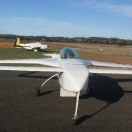
Home made is *exactly* what it was, the owner built it and obtained an amateur built experimental airworthiness certificate on that basis.
-

Do we have this requirement here in AUS for RAA aircraft.
saccani replied to SSCBD's topic in AUS/NZ General Discussion
The metal jacket is an extra cost, optional feature. Being Australia, they import what they want to sell, not what we want to buy. The great irritation is that we are forced to pay extra for a “feature” we don’t want and really should be removing for aircraft use. For those employing a LAME on their experimental or LSA, the removal comes at extra cost.... -
RFS air tanker feared crashed in NSW
saccani replied to BirdDog's topic in Aircraft Incidents and Accidents
One of the gentlemen here says they were using retardant, which makes sense, in which case they would drop in a line ahead of the fire, normally downwind or upsIope. I don’t know the specifics for Coulson’s employment of their RDS XXL system. Typical C130 drops are in the order of 150 feet above the vegetation @ 125 knots, with minimum safe drop above the surface at lowest release rate of 130 feet, at max rate, 249 feet, including 50 foot safety margin. That’s to avoid knocking trees over and killing people. You want it to slow down and fall vertical. I don’t think even a 747 would drop at 1,000 feet. Drop computers only used to go to 400 feet maximum, maybe they go higher now? In practice, many drops may end up being made below these heights. RDS can dump at an emergency flow rate to empty in 2.5 seconds, you really want one second, but that’s not too bad. MAFFS, the common Hercules system, takes 4.3 seconds. If you consider wind gusts in the order of 50 knots in the area, the possibility of fire related microburst etc..., or a wind reversal, there is not a lot to play with at drop height. Hot conditions, dirty configuration, rising ground, it’s very challenging indeed. It doesn’t need a mechanical issue to put you in, but it also is a factor of course, and it need not be a major one - one engine or prop misbehaving at just the wrong moment, when much of the margin has already been used, and you can’t climb faster than the ground is rising. I don’t think the relatively long transit times help, the weather can be different by the time you get there, most likely worse on a stinking hot day. It would be nice if there were more places to load the aircraft. The drop heights given above do get increased to allow terrain escape, but they should give an idea of where they typically operate on the drop. I have seen drops below 15 feet - this is, of course looked at somewhat askance. -
RFS air tanker feared crashed in NSW
saccani replied to BirdDog's topic in Aircraft Incidents and Accidents
Having had a chance to look at some pictures of the scene, the degree of breakup and the distribution of wreckage are consistent with other C130 crashes I have seen from CFIT. However, I can only positively find one wing and it’s two engines in the wreckage, and one piece of wreckage which is a bit blurry but is consistent with the third engine. The trail of wreckage seems consistent with controlled and level flight. The absence of propeller blades near the engines is consistent with a high level of power on impact (if not developing power, the blades are usually found still on the hub next to engine), which is easily determined by inspection of the turbine section. I don’t suggest pilot error in the sense of making a blunder, but operating by necessity in a very demanding environment with tight margins, they may have run out of margin. Many Hercules tankers don’t have an emergency dump provision, just dumping at max. rate if they have a problem. Fifteen tonnes may not sound like a big load, but it can make a big difference in climb performance - how much of their load was dispensed prior to orientating towards rising terrain is unclear. If a strong down draught or sudden reversal of wind was present and the load had not been fully dumped, the aircraft may not have had enough climb performance to counter that and climb above the rising ground. It may be that they were let down by the lead aircraft. The investigators will of course have better information to figure out what happened. Whatever happened, it is inconsistent with a strong nose down attitude at first graze. -
RFS air tanker feared crashed in NSW
saccani replied to BirdDog's topic in Aircraft Incidents and Accidents
Just for speculation, there was one some years ago that had an entire prop blade break off and go through the fuselage, cutting a lot of control runs. That was through criminally negligent maintenance of the prop, where corrosion was detected at the hub end and they couldn’t be bothered to do anything about it and just put it back together. -
RFS air tanker feared crashed in NSW
saccani replied to BirdDog's topic in Aircraft Incidents and Accidents
Indeed, but the retardant is mostly water, with a thickening agent, colouring agent and an environmentally friendly retardant like ammonium sulphate which act like a fertiliser afterwards (borate based ones tended to kill everything). -
RFS air tanker feared crashed in NSW
saccani replied to BirdDog's topic in Aircraft Incidents and Accidents
If you look into the maintenance history of the previous C130 structural failure in the US, you will find a years long gap on the records when it was being used by the CIA. It was speculated that unrecorded high g loading in sneaky operations may have been a factor in the early centre wing box fatigue failure. I looked into the history of this airframe (#4904) a while back, it was built in 1981 as a Naval EC130Q TACAMO, a fairly relaxed role from the structural point of view, essentially a communications relay for a global thermonuclear war. It then had the special electronics removed and was placed in AMARC, with engines etc removed before Carlson got it for aerial tanker conversion. It’s basically a C130H. The earlier failure was with one of the early production C130A, which had some significant structural issues which were corrected in later models. The 2012 crash was not a structural failure, but due to a microburst producing a down draught that exceeded the climb performance of the aircraft at full power, even after it dumped its load. They didn’t have enough height to fly out of it before they hit the ground. -
In late 1990 early 1991, as I recall it, 0730/1930 local was the peak time to get a NAVSTAR fix in Arabia, with the visible constellation reducing either side of those times. I think there were at least six hours a day with nothing in sight, longer where you would have trouble getting a solution. If you are serious about that flight and having a back up, I'm working on validating the performance of an Italian integrated INS/GNSS solution based on Spanish UAV sensors intended for GNSS denied areas. If it works as advertised it should give you everything you need. www.aircraftspruce.com/catalog/avpages/avmap-ultra-efis-2.php That's to solve the "Find Honolulu problem" for a C1a MTOW<500 kg circumnavigation if GNSS is tits-up. INS drift over 2,000 nm should be in the order of 30nm - presumably, GNSS failure before PNR would have a diversion, so the INS drift would be less as it would have a more recent position. Put a small camera that talks to an ipad underneath the aeroplane. As well as being helpful for pilotage, with a transparent overlay of a protractor, you now have a drift meter to supplement your DR. Of course the whitecaps are moving, but it still gives you insight into very different winds aloft than forecast, if your GNSS solutions fail. For curiosity's sake - the regs still make provision for you to drop drift bombs for this purpose. These are wooden bombs full of golden glitter, or smoke pots and flares. The idea is that wave movement is faster than currents, so you get a better drift reading with something on the surface, rather than a white cap. I don't see anyone being prepared to bother with such a thing nowadays, other than for having a legal excuse to drop bombs from an aeroplane! But a basic drift meter is cheap, simple, light and useful for 'looking' through the floor of the aeroplane. Part of the back up plan should include a late model ipad and/or high end android device - the consumer GNSS has access to many more constellations than most of the TSO equipment. Garmin only work with NAVSTAR and GLONASS, for instance. Some of these phone GNSS even have access to the NAVSTAR civilian L2 frequency. It would seem entirely reasonable to me if that it's all you used. Full on celestial navigation is probably impractical, but an astro compass could be helpful. I did some airborne testing using precomputed sight reductions using an iphone "sextant" app, the best I could do was about 100 nm, 130nm more like it - however, I never got around to calculating index error, which presumably would tighten that. 100nm won't get you there. If you look at what Chichester did, going the other way across, it could be a useful last ditch defence. You make sure, in effect, that you will definitely be left or right of the destination at a precomputed line of position, using something simple like a sun sighting, you then know to turn right or left to find the destination. Which all sounds silly given how ubiquitous positioning information is for us today. And there would be a lot of learning to use them. Given that these are fairly long legs, if you accept that multiple GNSS alone is sufficiently reliable (which is entirely reasonable), you could simply use that to track your position as you follow a constant heading course using the bellamy drift equations. You use the barometric pressure predictions corresponding to your cruise altitude and the mean latitude between origin and destination to calculate the net drift over the leg. Instead of following a track on the ground, you take the shortest path in the air. This is of greatest importance on long legs where reversals in drift direction occur. By staying fixated with a great circle on the surface, your drift corrections to stay there mean that you use more air miles to get between A and B. Using the constant heading, you may be left or right of the great circle route on the ground, but you aren't wasting effort to go first left then right in the parcel of air. Savings in the order of 30% of air time/miles were found using the Bellamy drift method. But you do need to be able to fix your position when going towards a little island rather than aiming at a continent. As you get close, using your fixes, you make up for any errors in the computed Bellamy drift and arrive at your little island earlier with more fuel. It does mean that if something goes awry, you won't definitely be able to tell if you need to turn left or right to search for the island if its LOP comes up and you can't find it. Drift nm = 635*(|p2-p1|)/(sin(mean latitude)*TAS where p2-p1= difference in hectopascals of the pressure at cruise altitude between origin and destination. Looking at the forecast weather for 17Jan, it's probably worth about 10% to Lord Howe and 15% to Norfolk. For the 18th, it could make a 30% difference Bankstown - New Plymouth. Also handy is that if the pressure is the same at both points, you head straight for it, ignoring winds aloft in between. For the southern hemisphere, if the destination pressure is higher, the drift is right and the wind correction heading left, if the dest. pressure is lower, the drift is left and the wind correction heading is right. Vice versa for northern hemisphere. Whilst I don't recommend this, with a ranging altimer (radar/lidar) you can also do pressure navigation. As you sit on a constant pressure altitude, you are actually going up and down in relation to the earth, which the radar altimeter can measure. By using the radar altitude over the sea, you can get a pressure line of position against the synoptic. There are some home made radar/lidar altimeters that are reasonably light, cheap and simple. As a last ditch navigational defence , a pair of daylight visible lasers could be aligned to give you some reasonable altitude above the sea, say 200 feet, the pressure at this height could then be used to give you a pressure line of position to follow to your island. If you have comms, you can find out the current pressure at destination and follow it in. I won't go into the details of pressure navigation, as we have GNSS, but it is surprisingly powerful. The part that remains useful in the GNSS age is the Bellamy drift for constant heading navigation. New Zealand is a much bigger target, maybe a good ferry tank and direct routing might be better? ? It's a long way to the islands without an alternate, maybe a small ferry tank to allow reaching Norfolk, the mainland or NZ would be prudent if island hopping? You should have no difficulty in configuring the BD4 for 1,600 nm with reserves, you don't even have need an overweight take-off with 200 kg load. That'll leave you with a range from Bankstown to divert anywhere in NZ if you have to. It's a good deal shorter than the island route. I hope you give it a go. regards, Paul


