Admin
-
Posts
9,304 -
Joined
-
Last visited
-
Days Won
109
Content Type
Profiles
Forums
Gallery
Downloads
Blogs
Events
Store
Aircraft
Resources
Tutorials
Articles
Classifieds
Movies
Books
Community Map
Quizzes
Videos Directory
Everything posted by Admin
-
That is strange...the only thing off the top of my head that may cause that is the link is using a https://www. and you may be using the site address without the www which means your saved log in is what is causing the issue. The easiest way is that once you are on the site, click the "Envelope" icon towards the top of the side column and go to your conversations that way...try that

-
I just logged in as you and didn't find any issue. The fact that you have logged in to make your post means that you should be able to reply to a conversation, no extra password is needed. Can you take some screen shots of the issue you are having and show me
-
As many may know I get coding and Admin support from @Ahmed Zayed who lives in Egypt, well he has just become a father for a 2nd time so a HUGE congratulations from everyone here at Recreational Flying
- 4 replies
-
- 13
-

-

-
 This thread has been closed
 -
Country Airstrip Guide NSW Download
Admin replied to Aussie Aviation's topic in AUS/NZ General Discussion
If it is a 2003 version should it be a allowed to be downloaded as it will be full of incorrect info...dangerous -
Are you referring to an "Over shoulder bolder holder" or also referred to as a "Double barrel sling shot"
-
There are creams for that
-
Personally I would give a high score of just a sore throat for it to be worthy of a test
-
Please be advised that we must play the subject...NOT the man or else suspensions will reluctantly be given, I don't want this and I am sure no one else does as well...thanks for understanding
-
It will be a download but probably not a complete 150gb as that is what is needed in terms of hdd space to run it but maybe 130gb
-
I pre ordered my copy today as I was able to get the Premium Deluxe edition at a discounted price of $142 AUD. It is being released on the 18th Aug and it is reported to need 150gb of hdd space. The screenshots look incredible especially the terrain.
-
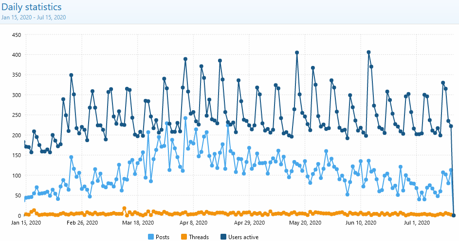
Unfortunately only the Xenforo software has the numbers stored and can create the chart and as we were using IPS software prior to the start of the graph I don't have those figures
-
Out of curiousity what other things are you guys interested in like Cars, Boats, Gardening, Technology, Jobs, Home Maintenance ?????????????????
-
We need many more posts of value to entice new users and to get discussions going
-
Just Recreational Flying
-
Did you know that generally the most popular online communities all started with a specific subject or obsession...many started by just being an online community about a specific computer game or other specific thing. However, they all diversified broadening their appeal into many other areas. For example that one specific computer game spread to other computer games and then to general life subjects and ended up forums catering to everything and which that specific computer game still exists on their site but just as 1 of the many different subject forums they have on their site. Most top successful forums also have more than just the forum function as well like i was trying to create when we used the IPS software. One specific feature they have is that users can fine tune areas like Whats New to just the subjects they are interested in, something you can't do in here (Xenforo software)
-
Looking at the site statistics today and I am alarmed at an obvious downward trend. The number of "registered" users coming to the site every day seems to be maintained at an average of around 250 to 275 per day however years ago we were averaging 600 registered users per day peaking at up to 1,000 (the graph peaks are a result of the weekly email that goes out). I believe this drop is caused purely by Facebook. But what is concerning is the huge downward trend in the number of posts per day. This could be caused by Covid-19 but I would have thought that the numbers would increase given that everyone was in lock down spending more time on the internet. Let me explain what happens when the number of posts drop...there is less to read resulting in less interest resulting in less posts again and as it keeps dropping the number of registered users coming to the site each day begins to drop...the end result is the site's closure due to cost/benefit. The other thing is when the number of registered users start to drop, which I feel we are approaching, a turn around is extremely difficult, the term "free fall" comes to mind. This site has been going for some 18 years and in its heyday, before Facebook, it was the go to place for all recreational aviators to get help from each other, discuss one's flying experiences and to just get social with other like minded aviators. We need to do something...but I don't know what!!!!!!!!!!!!!! Your thoughts?????????
-
If I look at it in simplistic terms there are only 4 reasons you can leave home and flying doesnt fit into one of them so even though there is nothing explicit that is the way I would look at it
-
His name wasn't Corporal Klinger was it?
-
I might be looking for a helpful person who might accidentally fly over the border, land and ask for directions and being aviation safety conscious I would have to hop in and fly with you for precise directions to Queensland...it is very dangerous for a pilot to get lost
-
We won't Red, what you have added is an enormous asset to every user of the site and must be protected even to a point of even paying out money to ensure it is protected in any consideration of software
-
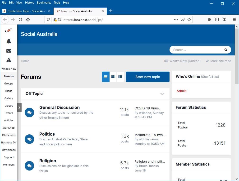
As some will know, the Off Topic site Social Australia (.com.au) uses the IPS software solution which recently released an exciting new update (still in BETA stage) which I am working on and when fully released Social Australia will be updated to it, it really is that good with the extra features they have added. So Social Australia is staying with IPS Xenforo on the other hand, which this site (Recreational Flying) is based on, released an update today, again in BETA, but having a look at it I can clearly say that I don't like it, not one bit, and I don't believe you will either so I thought that I would let you know that Recreational Flying is sticking with the current version of Xenforo...just in case you visit other sites that use Xenforo and notice they end up different to this one Some screen shots of the IPS update being developed on Social Australia (still working on cosmetics):
-
So some of you prefer the same side column menu system and fluid width page display. There is a lot involved in whey I have currently set the display the way it is on Social Australia so i have recorded a video to explain the reasons why but note that it is my current view which is being evaluated and may change. If we stick with the way that Social Australia is then I may be changing it here as well. Interestingly I did a poll about the Fixed vs Fluid view here and out of the hundreds of users that come here every day only 2 people responded: https://www.recreationalflying.com/threads/fixed-or-fluid-width.72497/ Here is my explanation:
-
I have been looking through the IPS update that was shown on their site the other day and there are some great new features in it that will soon come to Social Australia (.com.au), the off topic site