KRviator
-
Posts
1,165 -
Joined
-
Last visited
-
Days Won
17
Content Type
Profiles
Forums
Gallery
Downloads
Blogs
Events
Store
Aircraft
Resources
Tutorials
Articles
Classifieds
Movies
Books
Community Map
Quizzes
Videos Directory
Everything posted by KRviator
-

no Avgas - Rocky Gladstone Thangool
KRviator replied to Ironpot's topic in AUS/NZ General Discussion
The ASA NOTAM quality guide. A perm change will be NOTAM'd though ASA makes no assurance to the accuracy of it. A temporary change or restriction does not require a NOTAM. -
no Avgas - Rocky Gladstone Thangool
KRviator replied to Ironpot's topic in AUS/NZ General Discussion
Lack of Avgas is not a NOTAM-able event. Best you not rely on that and check with the supplier directly. -
Full Medical? I just did a Basic Class 2 with my GP - so long as you can convince him you're safe to drive a commercial vehicle, you're good to go - it took all of 15 minutes and $10 to CAsA - and let's face it, if you can't meet the standards for a Basic Class 2, are you really safe to fly, yet alone in CTA? Full licence? An RPL with CTA / CTR endo's is all you'll need. You can port your RPC to an RPL at any time by filling out CAsA form 61-1RTX. Then a couple of hours for your endorsements and away you go. My only concern with the weight increase is if CAsA turn around and say "Anything over 600Kg needs a LAME", where they should take a leaf from the Canadian's and have owner-maintenance for 'basic' certified aircraft used in PVT ops.
-
This kind of debacle, coupled with the RAAus attack on OzRunways vs Avplan and the RAAus vs AOPA trademark bollocks a couple years ago only serves to drive the knife further into sport flying in Australia. We already have CAsA doing their darndest, we dont need our administrators adding fuel to the fire...
-
You're an order of magnitude out. 25 grams per balloon, by 20 balloons is 500 grams. ?
-
That reminded me of the ill-fated Balloonfest in the US. 1.5 million helium balloons, and half of them landed in Lake Erie.
-
You'd be surprised at the weight of a persons cremains. I'd estimate my mates at around 5kg, and plugging that into a web-based calculator suggests in excess of 400 balloons would be needed. Though I do like the idea!
-
Nope. ? I built the -9, I built the pod, test flew it empty, test flew it loaded, and tested releasing simulated cremains. Same as the GoPro attachment on the fin. I installed it prior to the first flight so it was there as part of the flight test program. If CAsA want to make a song and dance about it later on for the next buyer, they don't have a leg to stand on.
-
I scattered the ashes of a pilot mate from my RV-9 last year. I built a small pod that bolted to the wing tie down and used a pair of linear actuators to open the bottom door. With minimum fuel his wife was actually able to come with me and be the one to press the button over the mountains northwest of Brisbane.
-
If you are going to have a wire strike
KRviator replied to a topic in Aircraft Incidents and Accidents
A (very) quick look through Ausgrid's network standards shows the average LV residential cable is 95mm2, so a diameter of around 11mm. The breaking strain for 11mm wire rope is in the vicinity of 16,000lbs, or around 7.2 tonnes. Snagging one isn't going to worry the cable much at all, maybe dislodge it from an insulator or two, but that's it. -
Send the invoice to RAAus, RAAus passes it onto the member. If not paid within X months, aircraft is de-registered. Cost to employ a data-entry clerk in the office 3 days a week: ~$40,000 per year, including super and payroll tax. Hell, I work part-time now, I'll do it for $30,000 a year working from home! Across the 13,000 RAAus members, that's $2.50 a year to keep your private details private.
-
One thing the OIAC noted was that for them to investigate my complaint, my privacy had to have been breached - it wasn't sufficient that it could be. In my case, I was lucky as when I was talking to the investigator from the OIAC, at the time I had no evidence it had been, but when I got home from work interstate the following day, there was an invoice for a landing I did at Warnervale over a year ago when I had an ADAHRS sensor failure and didn't feel comfortable returning to Somersby. So I promptly called them back and said "I have that proof now!" and they agreed it was serious enough to pass on to their investigation team.
-
The synopsis of my complaint was that they collected my details years ago under "Privacy Policy 2.1", to manage my aircraft registration and RPC, however, then entered into a commercial arrangement with a third party (the AAA) and changed their privacy policy to include a term I did not accept when I signed up, thereby allowing any number of fourth-parties (the airport operators) access to my private details. There's several other pertinent points that the OAIC was most interested in, but that's the basics for me... Notice it doesn't say The General Public.... CAsA, yes. The ASAO, yes. Joe Q Busybody? Get stuffed.
-
My complaint to the OIAC was also upheld, and will be passed on to an investigator for them to look into, when they can spare the time - sounds like they are well and truly swamped with complaints at present. I won't go into the details too much as I don't want to give RAAus any ammunition with which to mount a defence, but it could be an interesting fight nonetheless.
-
I did the MPC last year - and while I did learn a bit, the whole process simply struck me as a way to penalise the pilot/builder/maintainer if it went pear-shaped. It's a paper trail, nothing more, nothing less. But CAsA says we have to do it, and the SAAA is the unfortunate meat in the sandwich. I built my -9A, at present, I fly it under RAAus and sign off the maintenance as a L1. But soon as I put letters on the side, hopefully over the Xmas break, I need an MPC, Experimental CoA, MR, W&B authorisation and (another) flight review, to fly the exact same plane that the fortnight before, needed none of that. Time to hang up the headset and buy a fourby, methinks. ?
-
Time to sell the Brumby and get a boat. Much as I love having the RV-9, I'm over the bullshyte security, outrageous fees, medicals, RAAus politics and other superfluous fluff I need just to go aviating - and am probably going to sell the -9 early in the new year. It just isn't fun anymore.
-
Also check out Mark Rober - he's the guy that built the parcel bomb to catch out package theives - but he goes into the science in an easy-to-understand way which is downright enjoyable. Between the two of them, and FailArmy, they occupy about 90% of my YouTube time. ?
-
Just goes to show someone else can love a narcissist besides themselves...
-
Pretty sure all new transponders need to be Mode-S, so about $3000 for the box maybe $500 for an encoder, and $1000 or so to fit, depending on how complex your installation will be.
-
Nav receiver for no fr in experimental
KRviator replied to joeyo68's topic in Instruments, Radios and Electronics
That's correct. All new IFR installations require a C145/C146 GNSS to drive your ADS-B. Garmin has released a couple new boxes, plus an indicator like a G5 configured as an HSI and you should be able to fit one for less than $20K. Still a BIG chunk of change though... -
I am sure the maintenance figures, are not cheap - I'm not disputing that at all. The problem is "they", councils etc, are passing on those distinct airport mowing-and-maintenance charges to the users but not anywhere else. They are not passing on the mowing and lighting charges for the use of my local park to me when I take my kids down to kick the footy or ride their bikes on the waterfront cycleways. They are not passing on the boat ramp maintenance charges to my neighbour when he launches his tinny at the brand-spanking $1.5-million-dollar facility at Koolewong, or ties up to the local pier, nor are they passing on the maintenance charges to park my car at the car park at the beach. Why not? Because in each of the previous examples, they are community assets, and their maintenance has been incorporated into Councils annual operating budget - as should be airport maintenance, at least for Private fliers - no matter how expensive it is, for anything else is discriminatory. I can understand if a Council wanted to charge business operators as I believe they charge cafe's a lease fee if they want tables on the footpath for example, and if you are making money out of a community asset, the community should be reasonably reimbursed for it, but to use a community asset for my own private use (note - not exclusive use, if you leased a hall for a party, etc), then I fail to see a reasonable expectation that I should pay extra to use it when I am already a ratepayer in the shire. AAhhhh you say, but what if I am not a ratepayer in the shire? Then your ratepayers are welcome to fly down here and use my local airport, or the boat ramps - let's face it, Cessnock and Hornsby shire councils don't have a lot of waterways... Sure, it can be argued, "You use the facility, you should pay for it", but I have yet to hear anyone who actually uses that argument, provide a substantive case for why it only applies to the local airport not every other piece of council-owned infrastructure, like carparks, beaches, sporting fields. About the only example of "user-pays" for my local council I can think of is the pool - and at less than $25 for a family of 4 for all-day access, and free parking, even that doesn't compare to a lot of airports that charge well over $10/tonne landing fees. Even for a small four-seater like a Mooney you're still up for $15-20+ just to land, with parking often extra. Cessnock, $17 for a Mooney to land + 12.80 to park per day, Toowoomba $16.75 to land (per landing too, another airport that results in $180/hour for circuit training in my RV-9) plus $16.60 just to park - it isn't just Warnervale where they are gouging pilots, though that is my oft-used example as it is my local airport.
-
Had AvData developed a business model that issues timely and accurate invoices and had councils developed a fair and equitable charging system - instead of one that charges $495 in landing fees for an hour of circuits - though they have "generously" introduced an RAAus rate that reduces that to "only" $150 an hour now - it probably wouldn't exist either... Then again, you can't simply point and say "Those pesky RAAus pilots are avoiding landing fees..." when you look at the various threads on PPrune et al. and see the commentary from GA pilots that utilise false callsigns in an effort to avoid AvData owned charging systems as well. The publication of aircraft owners details is a separate issue, wrong as I feel it may be, the root issue is the majority of Councils do not see their airport as "just another council asset" that they are responsible to maintain in accordance with their ratepayer budget. "All them noisy airplane owners is rich" seems to be the common mentality and they then think we should be charged to operate from a 1.5km strip of bitumen when they wouldn't dare introduce a toll-gate on the road into town, or a $10 fee to launch your tinny at the local boat ramp (of which my local council has 46 across the shire and receives no income from). Now, Private strips are another story - and I agree yes the owners are entitled to charge for use, but it should be fair, something that isn't always the case. Though for example, I pay $300/month for hangarage and unlimited use at Somersby and I am quite happy with that.
-
Nav receiver for no fr in experimental
KRviator replied to joeyo68's topic in Instruments, Radios and Electronics
MGL make their N16 that utilises the SL30 communications protocol so you can drive it with an EFIS if you need to. Again, not TSO'd, and I can't recall if you need TSO to do NVFR. From memory, you do not, but I can't point to the legislation that says either way atm...I've got it in my mind that you don't need any navigation receivers for Night VFR though and the VFRG seems to support that. I picked up a KLN-90B from Ebay a couple years ago for $600, it won't do for IFR these days as it is only a C129 unit, but it will give you RNAV and push your position-fix times out to 2 hours if you need that. Really, you'd be wanting a GNSS unit over a VHF Nav as VOR's are going the way of the dodo, but it depends on your panel space. -
I noted this in my reply to the OIAC last week, along the lines of "To get access to the Motor Registry requires legal action or a court order, the RTA can't "simply change their privacy policy" to allow a shopping center to issue invoices. Begs the question why the Civil Aircraft Register is public domain at all. Boats aren't. Cars aren't. Motorcycles aren't. Planes? Well, they're owned by toffee-nosed rich people, so what if their details are in the public domain?!?
-
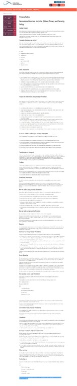
Looks like I can't edit the above to add the privacy policy as well, but here it is from RAAus website: https://shop.raa.asn.au/privacy-policy/ 1626 AEDT on the 23rd October 2019. Click HERE for a JPG if the embedded version doesn't work.